The assessment of images generated by a radar locator sometimes requires the know-how of skilled engineers. The use of AI to automate the determination process has made it possible for anyone to identify the location of buried pipes.
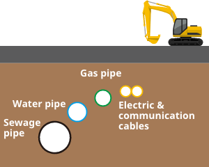
Since various infrastructure facilities are buried under roads, care must be taken not to damage buried pipes during excavation work for gas facilities.The location of buried pipes is estimated by referring to other information, including drawings. At Osaka Gas, we use radar locators to accurately identify the location of important buried pipes of other infrastructure.This makes it possible to prevent damage to shallower buried pipes by a cutter and reduce the number of test excavation (manual excavation to check the condition of buried pipe) locations.
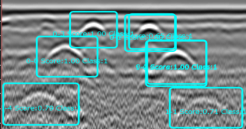
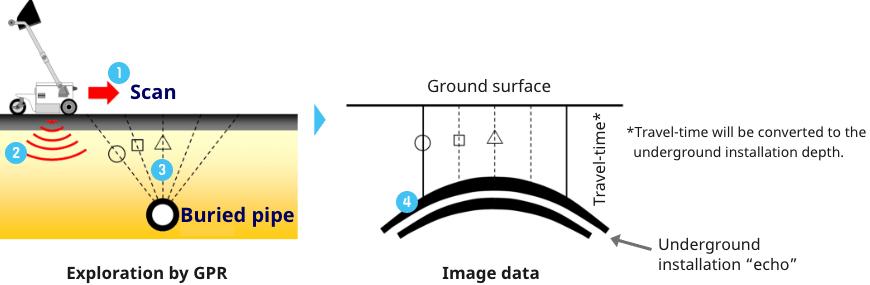
Radar waves emitted into the ground are reflected when they hit buried pipes. Radar locators take advantage of this characteristic to estimate the distance to buried pipes.
①The ground is scanned across a buried pipe.
②Radio waves are emitted into the ground during scanning.
③Radio waves are reflected by the buried pipe
④An exploration image of hyperbolic lines is generated.
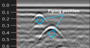
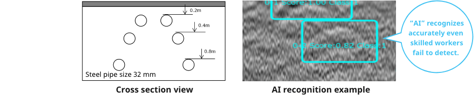
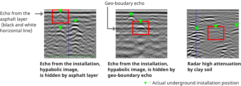
It is sometimes difficult to make assessments depending on the piping condition and soil quality. Thus, skilled techniques are required to reliably identify the location of buried pipes.
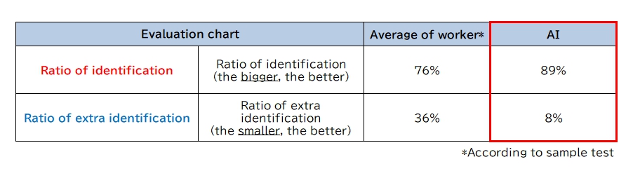
We have developed an AI which learned assessments made by skilled engineers, by using “sparse modeling,” an AI technology developed by HACARUS INC. that achieves training with a small number of samples.The AI has achieved an assessment accuracy higher than that of on-site operators on average. It has been incorporated into the underground radar sensor so that anybody can easily identify the location of buried pipes.